Holkham Nature Reserve
Wells-next-the-Sea, Norfolk
|

Location Guide |
This National Nature Reserve covers an area
of 9,768 acres from Burnham Norton to Blakeney. The main section is
from Wells to Holkham Bay and is crisscrossed by paths allowing access to
all the best wildlife habitats. It is made up of a grazing marsh, salt
marsh, dunes and pine woods. The windswept tide lines, the maze of
creeks and saltings, miles of dunes and sandpits, shady pinewoods, green
pastures and marshes give a mix of habitats and a blend of wildlife.
It is possible to explore most of the area
by following footpaths from the main settlements or from the 2 car parks
which are linked by the Norfolk Coast Path at Lady Anne's Drive and Wells
Beach Road, both have charges.
| What you are likely to see on a
Winter
visit:
Migrant birds, landing exhausted in the
seablite bushes in late October
Thousands of
Pink-footed geese
 leaving their
roost on Bob Halls Sand at Wells leaving their
roost on Bob Halls Sand at Wells
Large numbers of wildfowl such as up to 5,000
pink-footed geese feeding on the harvested sugar beet fields, but also
white-fronted geese,
brent geese,
 and wigeon in the fields on either side of
Lady Ann's Drive and wigeon in the fields on either side of
Lady Ann's Drive
At sunset the site of thousands of geese
taking off and flying in their skeins back to their sandbank roosts.
Brent Geese feeding in Holkham Bay
Flocks of larks, finches and pipits in Holkham
Bay
A peregrine or harrier being buzzed by a
cheeky blue tit or pipit
Mixed flocks of larks, finches and pipits in
Holkham Bay
On the tideline - lots of sculpted driftwood,
stones etc
Dawn sunlight over Stiffkey Marshes
Dew on spiders' webs in October
What you are likely to see on a
summer
visit:
Little and common terns fishing in Wells
Harbour
Dancing of the male ghost swift moths at
twilight
Saltmarshes covered in plants
Orchids in the Wells Dell in late June or
early July
Dashing flight of a dark green fritillary over
the dune flowers
Purple haze of sea lavender across the
saltings
An evening panorama from Gunhill
|

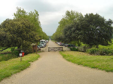
 Lady Ann's Drive Lady Ann's Drive
 Ian Lavender

Click on the images to see
larger versions

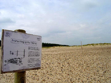
 A Nesting Beach A Nesting Beach
 Ian Lavender
 |
The main Pinewoods/Holkham Gap track runs
through the scrub and is a good place to see both birds and butterflies. In
spring the early flowers attract post-hibernating species like die brimstone
and the peacock and these are then followed by the orange tip, the meadow
brown, ringlet, common blue and large skipper. Scarce butterflies that have
been seen here include the green and purple hairstreak, comma and holly
blue.
The reclaimed saltmarshes between the pine
ridge and coast road has brought back large numbers of over wintering
migrants and recent peak counts have been 20,000 pink-footed geese, 7,000
Brent Geese and 13,000 Wigeon. From the hides in this area you may also see
Marsh Harriers,
Grey Heron,
 Lapwings, Redshank, Spoonbills, Teal, Kestrel in Spring, Yellow Wagtails
feeding around the feet of the cattle which are there to control the
habitat.
During the Summer when the beach/sand dunes are
also frequented by humans there may be cordoned off areas to protect wildlife
nesting and raising their young there. The Sand Dunes have wooden broadwalks
provided to minimise the impact of human footfall.

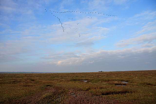
A Skein of Geese flying across
the Saltmarshes
 Hugh Venables

|
Location: Holkham Nature Reserve,
Wells-next-the-Sea, Norfolk |
|
Grid Reference: TF892440 |
Ceremonial County:
Norfolk |
|
Map Link:
Multimap

|
Aerial photo: |
|
Getting there: Holkham National Nature Reserve
is three miles west of Wells-next-the-Sea on the main A149, within easy
reach of Norwich on the A1067, King's Lynn on the A148 and London and
Cambridge from the M11 and A10. |
|
Access: From the Norfolk Coast Path and from 2
car parks, one at Lady Anns Drive and the other at Wells Beach Road. |
Website:
www.holkham.co.uk/naturereserve/
 |
Other Useful Websites:
Natural England
 |
|
Email: enquiries@naturalengland.org.uk |
|
Address: The Site Manager, Hill Farm Office.
Main Road, Holkham, Wells-next-the-Sea, Norfolk |
|
Postcode: NR23 1AD |
Telephone: (01328) 711183 |
|
Opening Times: At all times |
|
Charges: No charge to access, A car park
charge is payable at both car parks. |
Nearby Locations:
Holkham Hall and Park
 |
|
Other Location Pages: |
|
Notes: Dogs should be kept on leads and away
from cordoned off areas
|
|

|
Please let us know any other information that we
can add to the Grid(s) or page and any errors that you discover. Before making a long trip to any location it is always
wise to double check the current information, websites like magazines may be
correct at the time the information is written, but things change and it is of
course impossible to double check all entries on a regular basis. If you have
any good photographs that you feel would improve the illustration of this page
then please let us have copies. In referring to this page it is helpful if you
quote both the Page Ref and Topic or Section references from the Grid below. To print the
planning grid select it then right click and print the selected area.
Please submit information on locations you discover so
that this system continues to grow.
|