Thames Head
Second source of the River Thames
Cirencester, Gloucestershire
|

Location Guide |
 
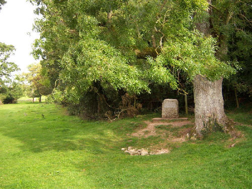
Thames Head as usually seen today
Historically the source of the Thames was said
to be at Thames Head, in a field near Kemble, not far from Cirencester. Old
engravings show it as a large spurt of water coming out of the ground, but over
recent times it was only a trickle in winter months.
A second source is at
Seven Springs
 ,
just south of Cheltenham. This is 14 miles further up stream, and has water
coming from it all year, but some call this as being the source of the churn,
while Thames Head is of the Isis, it depends on which you feel is the main start
of the Thames. These two join at Cricklade in Wiltshire. ,
just south of Cheltenham. This is 14 miles further up stream, and has water
coming from it all year, but some call this as being the source of the churn,
while Thames Head is of the Isis, it depends on which you feel is the main start
of the Thames. These two join at Cricklade in Wiltshire.
In very recent times a third start point has
come up, with the environment agency and ordnance survey listing the source as
being Trewsbury Mead. This is also said to be dry the majority of the
time. From the grid reference and what others have said, I thing Trewsbury Mead
and Thames Head is the same place possibly this is the name of the field as I
can't find any place called Trewsbury Mead.
At Thames Head quite a few years ago now, was the statue if Neptune, but this
was moved to the first lock on the Thames near Lechlade in Gloucestershire, and more recently a
stone marker has been put near where Neptune stood.
In recent times the water at Thames Head has become less reliable, 40 years
ago it was flowing in winter but not summer, although it was mostly a muddy brook
rather than any volume of water. Today it appears from time to time, not
always in winter, rarely after heavy rain, so there is no way to now when
its likely to be running.
 
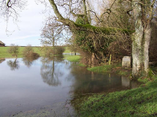
Thames Head as rarely seen this image
taken January 1st 2004
Water is said to more regularly flow
from Lydd Well, just to the NW of the A429 and NNE of Kemble. I haven't visited
this site yet, it is said to be two fields down stream from Thames Head.
|
Location: Thames Head - second source of
the Thames, Gloucestershire |
|
Grid Reference: ST980994 |
Ceremonial County:
Gloucestershire |
|
Map Link:
multimap

|
Aerial photo:
multimap (dry)

google
 (closer and better but still dry)
 |
|
Getting there: The Thames Head source
is about a quarter of a mile from the A433 outside Kemble. You will find on
the main road the Thames Head pub, a footpath goes from near here, crossing
over a railway line to the Thames Head point, you may need a map. |
|
Access: By foot only |
|
Website: |
|
Other Useful Websites:
Wiki -
Thames Head  Wiki -
River Thames

discussion on the sources
 |
|
Email: |
|
Address: |
|
Postcode: |
Telephone: |
|
Opening Times: on footpath in field |
|
Charges: None |
Nearby Locations: Cirencester
Gloucestershire Attractions
 |
Other Location Pages:
Seven Springs
 |
|
Notes:
|
|

|
Please let us know any other information that we
can add to the Grid(s) or page and any errors that you discover. Before making a long trip to any location it is always
wise to double check the current information, websites like magazines may be
correct at the time the information is written, but things change and it is of
course impossible to double check all entries on a regular basis. If you have
any good photographs that you feel would improve the illustration of this page
then please let us have copies. In referring to this page it is helpful if you
quote both the Page Ref and Classification from the Grids above. To print the
planning grid select it then right click and print the selected area.
Please submit information on locations you discover so
that this system continues to grow.
|