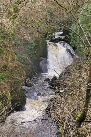
Snow Falls
On
Ingleton Waterfalls Trail,
Ingleton, Lancashire
|

Location Guide |
The last of the labelled falls, going clockwise,
on the Ingleton Waterfalls Trail, although there are more. You look back to see Snow Falls.
Snow Falls is in or next to Twistleton Glen,
and its woodland sits on the west bank of the River
Doe. It is owned and managed by the Woodland Trust and is a site of
Scientific Interest. The rock step, into which the Glen is cut is formed
because of the different resistance to erosion of the rocks laying each side of
the Cavern Faults. The stepped outcrops have created cascades and
waterfalls, in particular Snow Falls.
The dominating tree species here is Oak,
because of the acidic slate as opposed to limestone on the River Twiss. The
flora is dominated by grasses, although you may see some wild garlic and typical
moorland/heathland species such as bracken and fern.
The only access to this woodland is via the
paths provided for the Waterfalls Trail, from where the final footbridge takes
you across the River Doe into another wide rocky dell, where again some stop to
take a picnic. Smaller waterfalls continue through this area and particularly
from the last ridge you get to see some up close.
 |
 |
|
This waterfall is one of a number located on
the
Ingleton Waterfalls Trail
 access
is available from this trail which is open to the public (with charges), see
walks location guide for common details. access
is available from this trail which is open to the public (with charges), see
walks location guide for common details.
Waterfall on trail before is
Baxenghyll Gorge  going clockwise.
There are a number of small waterfalls below
this point, but we don't have them defined separately.
|

|
Please let us know any other information that we
can add to the Grid(s) or page and any errors that you discover. Before making a long trip to any location it is always
wise to double check the current information, websites like magazines may be
correct at the time the information is written, but things change and it is of
course impossible to double check all entries on a regular basis. If you have
any good photographs that you feel would improve the illustration of this page
then please let us have copies. In referring to this page it is helpful if you
quote both the Page Ref and Topic or Section references from the Grid below. To print the
planning grid select it then right click and print the selected area.
Please submit information on locations you discover so
that this system continues to grow.
|