| Home | Newsletter | Locations | Diary |
|
Indexes |
|
|
|
|
|
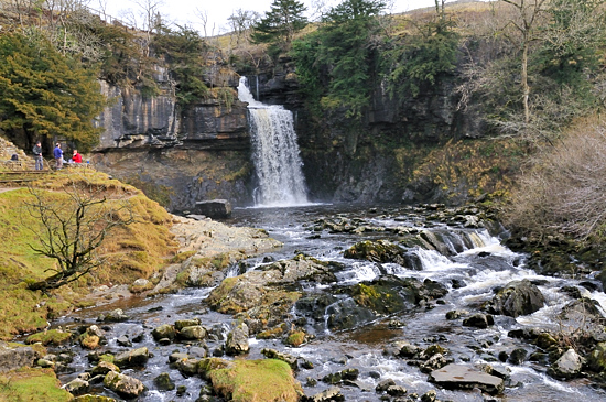
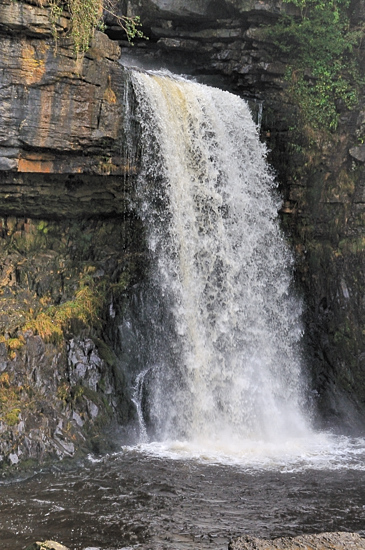
One of Britain's most photogenic waterfalls, Thornton Force is easily accessible and not difficult to photograph.
Thornton Force is roughly 50ft (14m) high where the River flows over tree lined limestone rocks in a wide cascade into the rocky pool below. It is situated in open countryside with few trees in front of it, so there are plenty of opportunities to photograph it from different angles. Here there are 2/3 seating positions around, but also closer to the falls there is a viewing area which can also be used as a picnic spot. The straight on view of the falls can be taken form the path, where you are in an elevated position ideal to capture it, and there is seat at this position. Just before you reach the seat, you can go down on the right and then along climbing over a large stone to get to a position nearer to the water level, allowing images where the river and rocks in the foreground are more noticeable. Closer to the falls, you have more of a side on view of this waterfall, and there are opportunities here to get to a number of positions to get different aspects. The path goes around to the north by a flight of very steep stone steps onto the top of the falls, and arrives at the top into a wide open grassy gorge, with water bubbling over the rocky river bed, twisting around into the distance a head of you. You can get very near the top of the falls. Going clockwise around the
Ingleton Waterfalls Trail
Please let us know any other information that we can add to the Grid(s) or page and any errors that you discover. Before making a long trip to any location it is always wise to double check the current information, websites like magazines may be correct at the time the information is written, but things change and it is of course impossible to double check all entries on a regular basis. If you have any good photographs that you feel would improve the illustration of this page then please let us have copies. In referring to this page it is helpful if you quote both the Page Ref and Topic or Section references from the Grid below. To print the planning grid select it then right click and print the selected area. Please submit information on locations you discover so that this system continues to grow.
|
||||||||||||||||
|
||||||||||||||||
.
|
||||||||||||||||
|
|
||||||||||||||||